
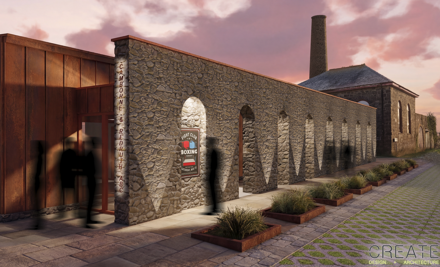
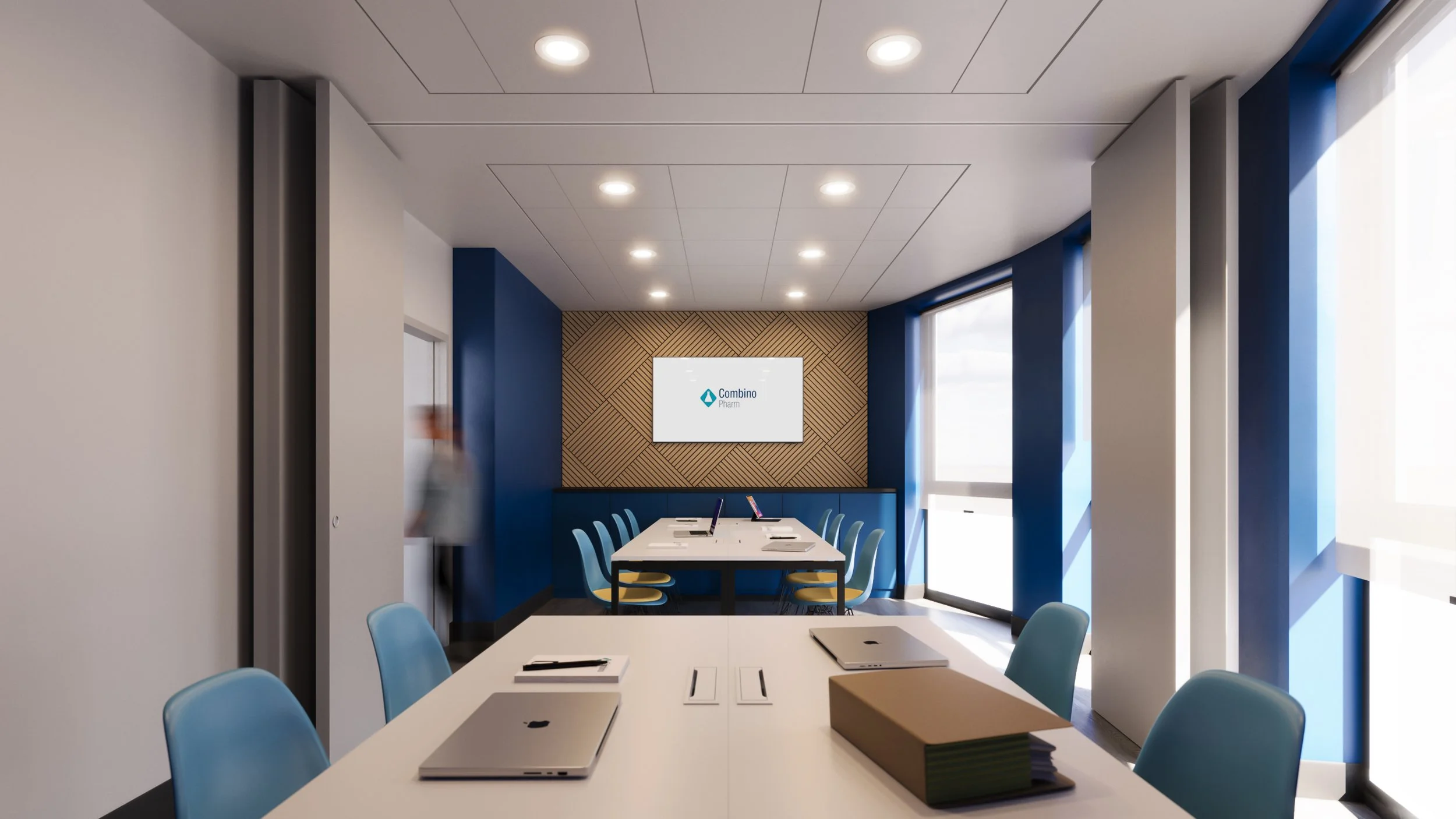
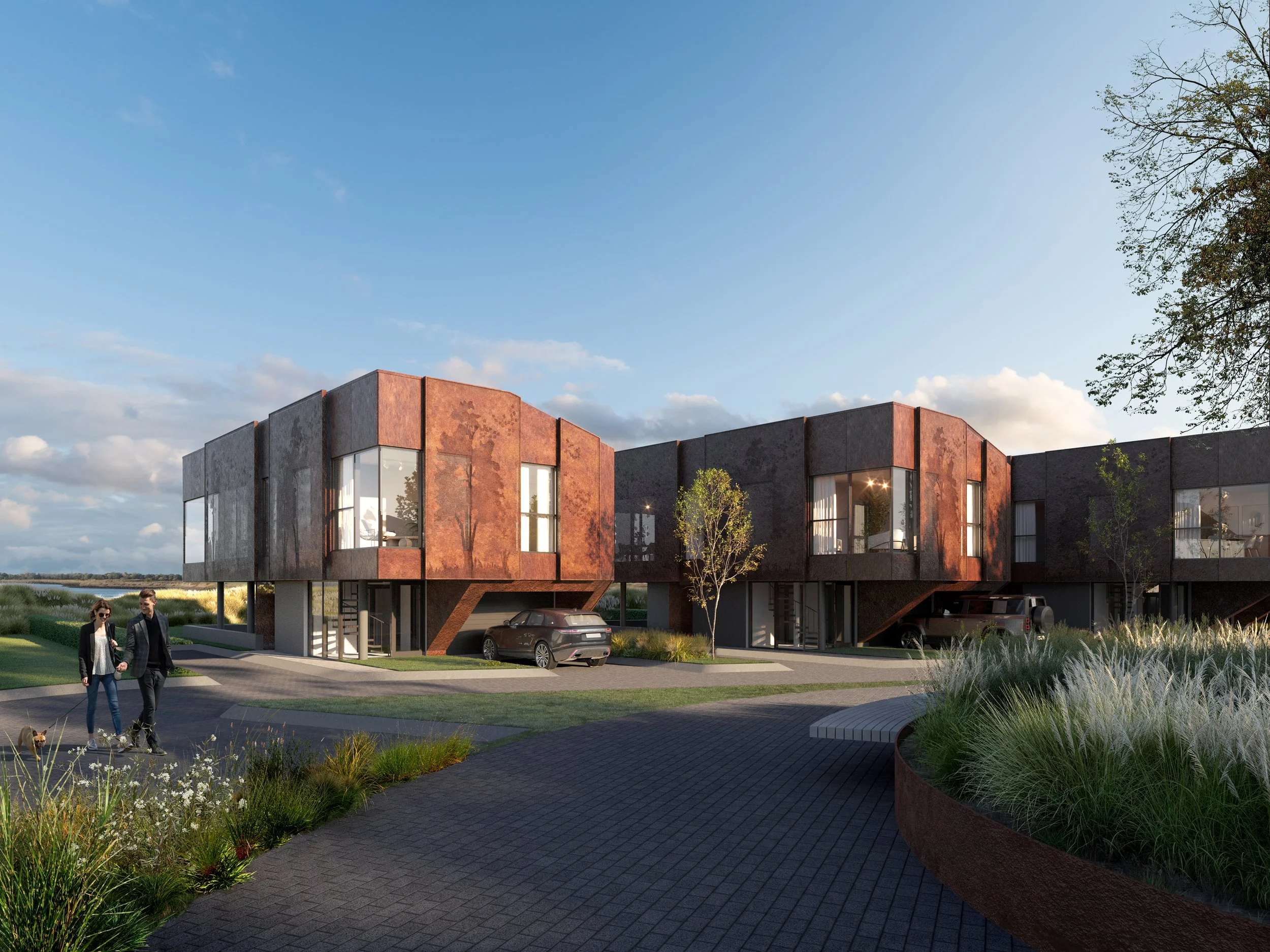
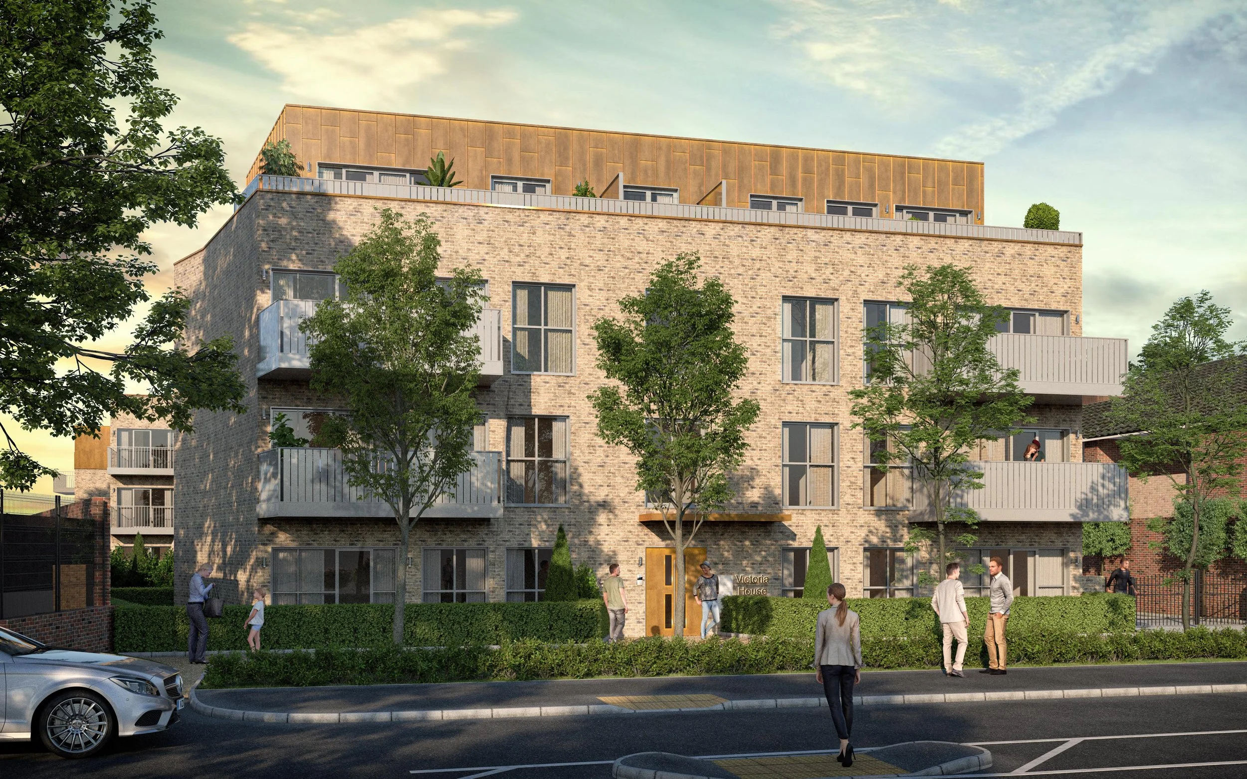
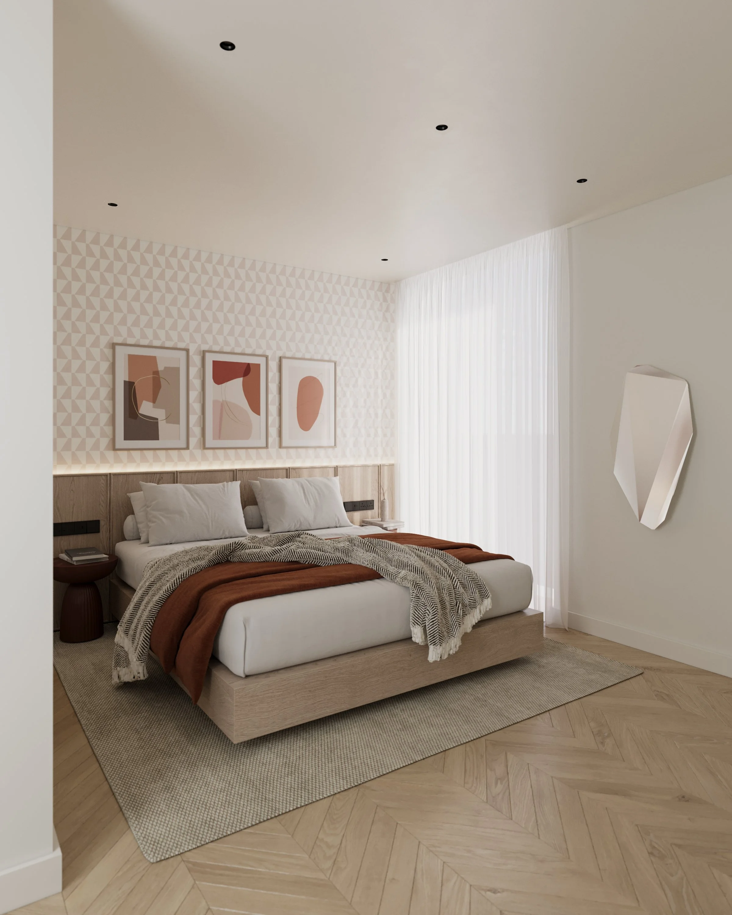
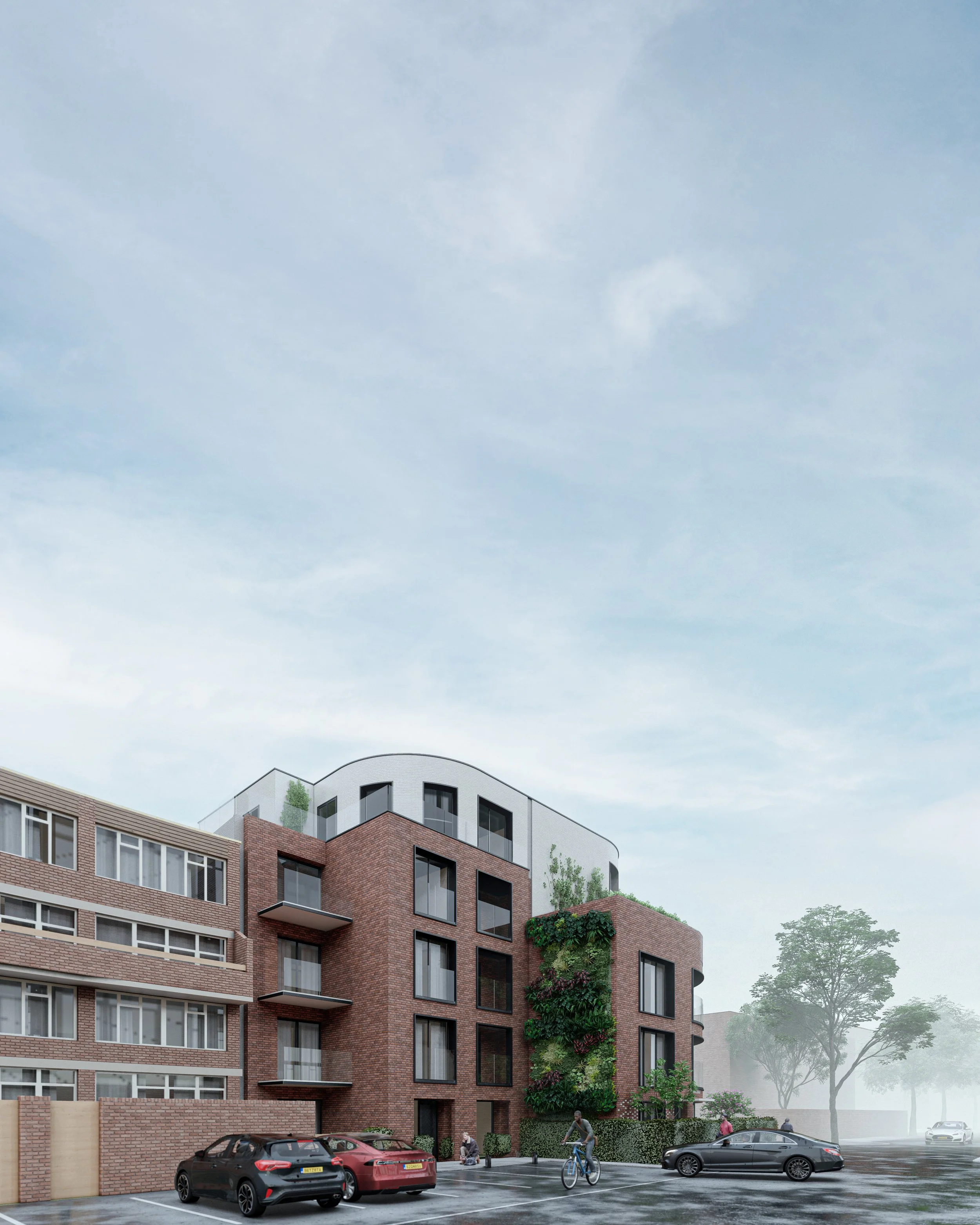
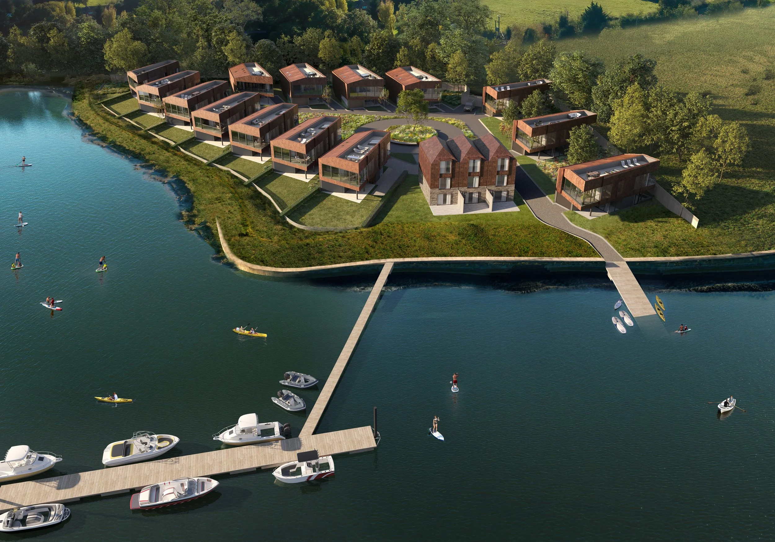
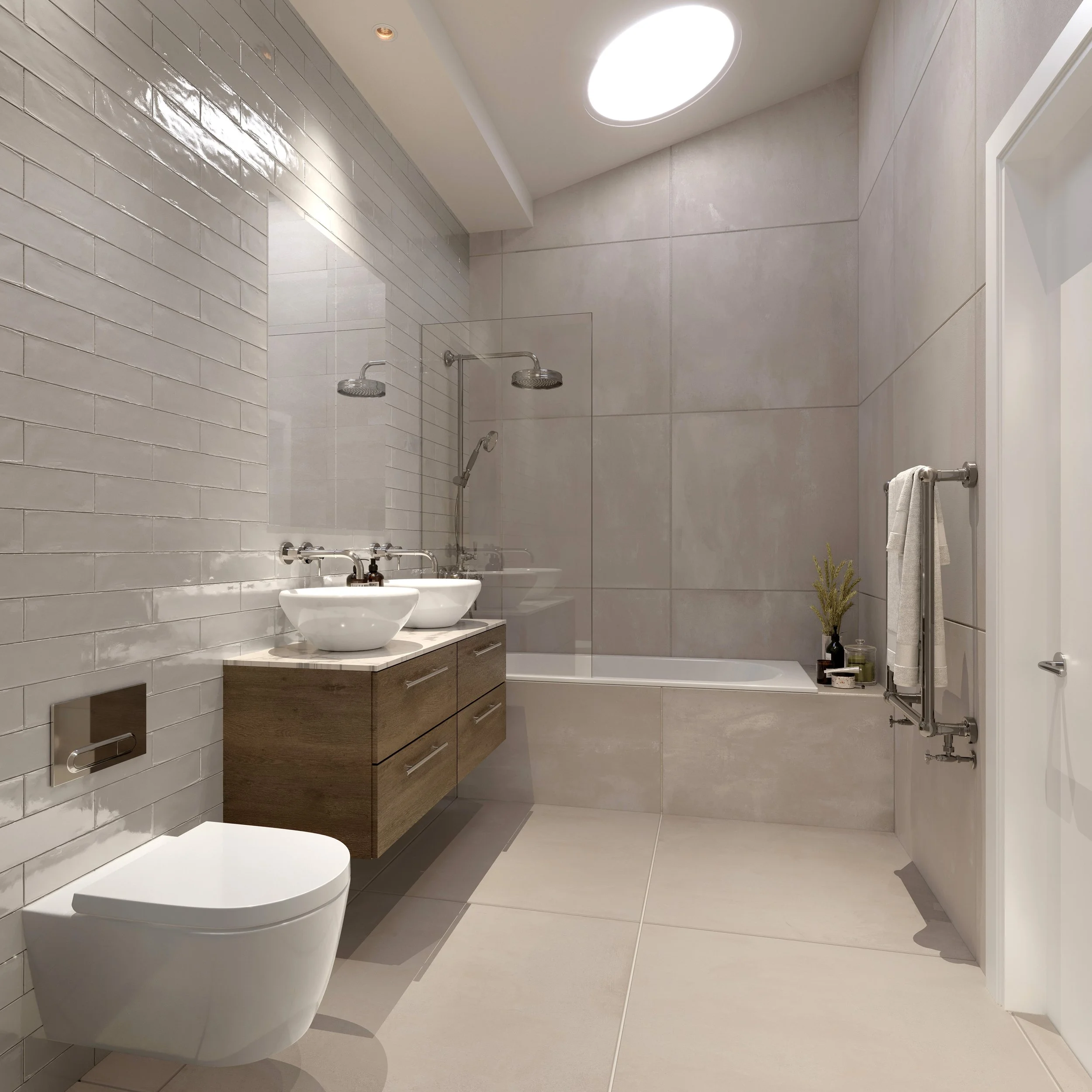
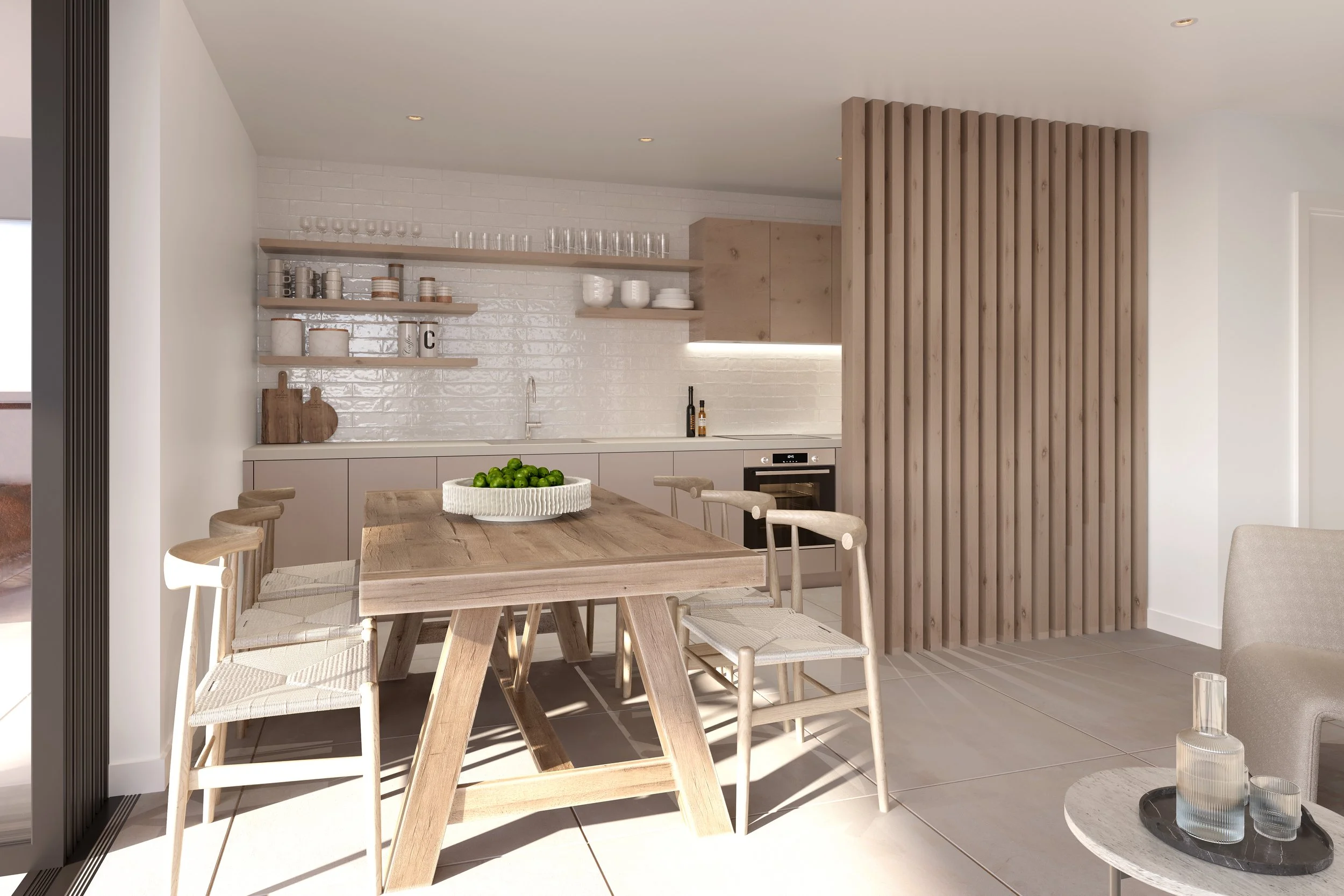
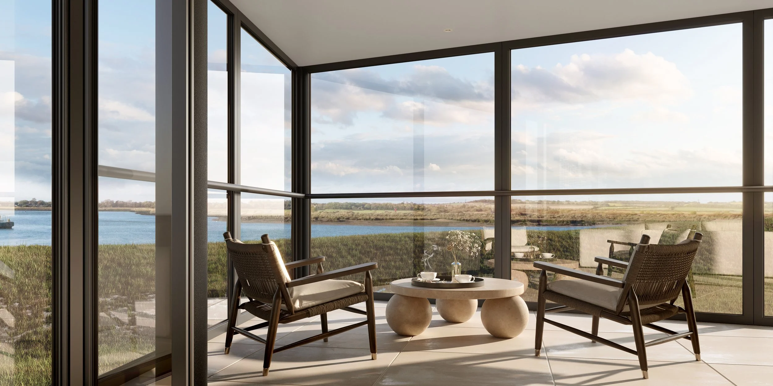
cgi & animations
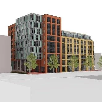
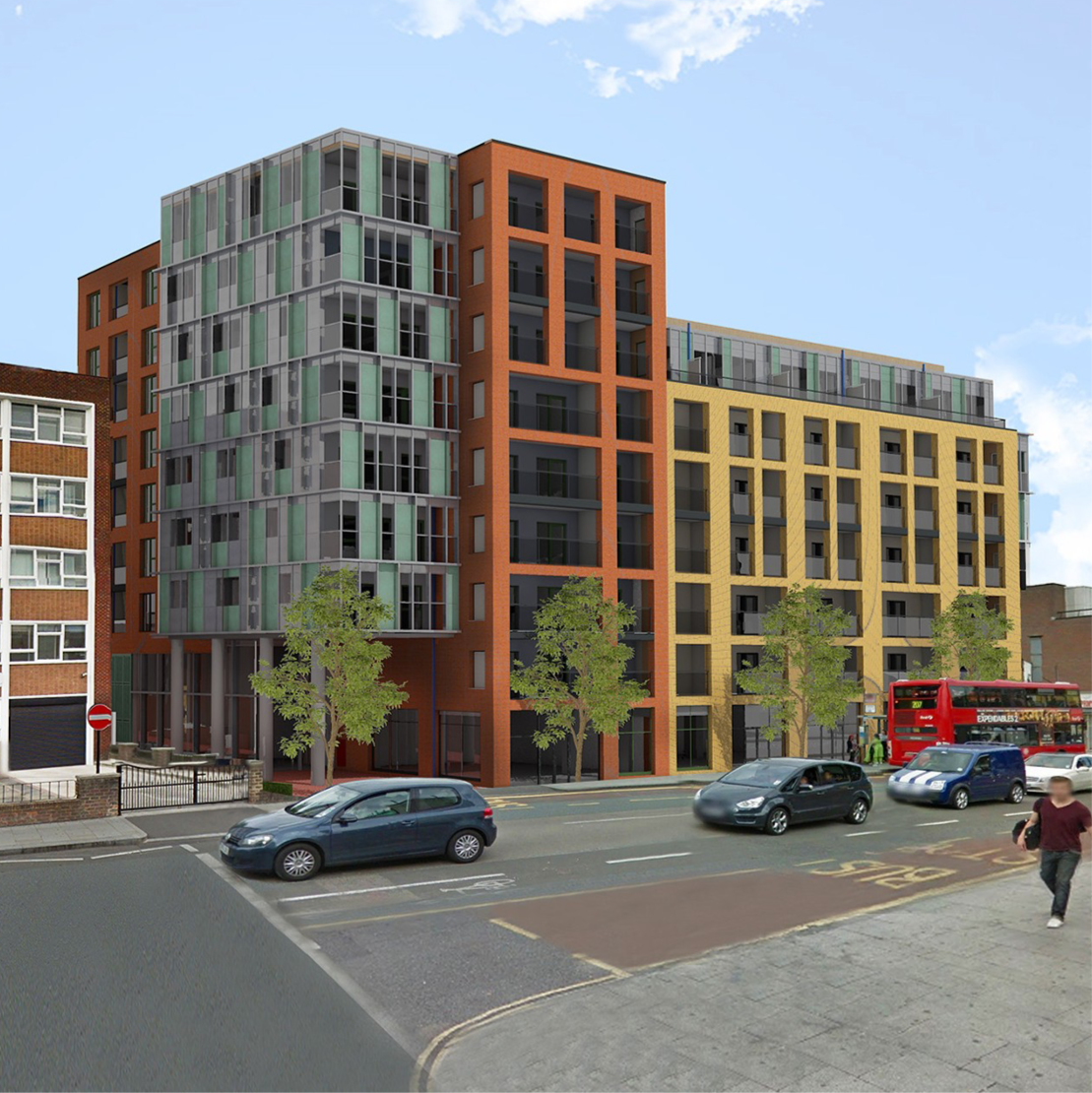
CREATE produces CGIs and animated CGI graphics whether it is for selling/marketing properties or visualising the finalised architectural scheme.
We use bespoke high-resolution textures, using local materials taken from the camera, to create seamless textures for the CGIs that can be populated with realistic-looking images and decorative backdrops to suit all situations. CREATE also provides live interactive models that be explored via a web browser or VR.

drone surveys
CREATE can conduct site surveys by drone, which get processed in-house and registered to Government Point cloud data.
Light Detection and Ranging (LiDAR) is an airborne mapping technique, which uses a laser to measure the height of the terrain and surface objects on the ground such as trees and buildings. We would always recommend a measured survey to be undertaken.building information modelling (BIM)
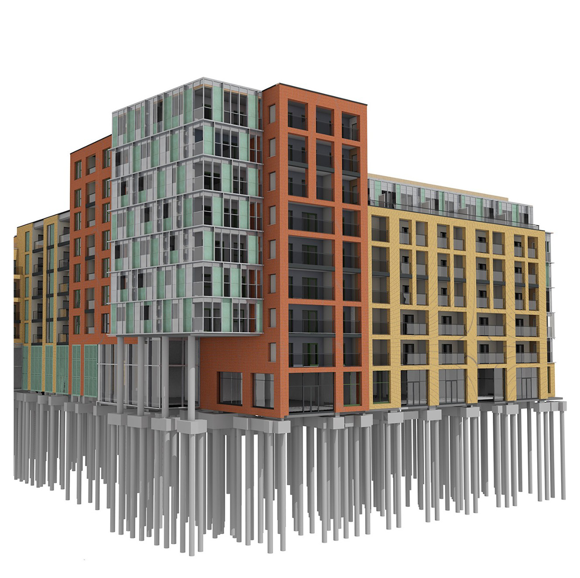
CREATE are BIM Level 2 certified, and we have developed our own bespoke BIM environment.
We use a range of software to make the best of BIM, ARCHICAD, BIMx, SOLIBRI, etc. and our creators are trained to provide BIM services throughout RIBA Stages 0 to 7.
RIBA Stage 0 to 1 - Initial Design
We place great emphasis on the development and efficiency of CAD and BIM systems in projects of multiple sectors and sizes. From our ever-expanding knowledge and experience, we are able to give our designers the most appropriate tools and information to deliver the best possible solutions.
RIBA Stage 2 - Pre-Application
We collaborate closely with major software vendors to improve our internal processes and ensure we meet BIM level 2 maturity in accordance with official documents and standards, including PAS1192-2:2013.
RIBA Stage 3 - Planning Application
Our active contribution to the development of these standards has ensured that our team is completely aligned with the BIM aspirations of the construction industry. This enables us to assist our clients in establishing a BIM methodology that is relevant to their needs. This includes achieving the government mandates that support level 2 BIM and government soft landings.
RIBA Stage 4 - Technical Design
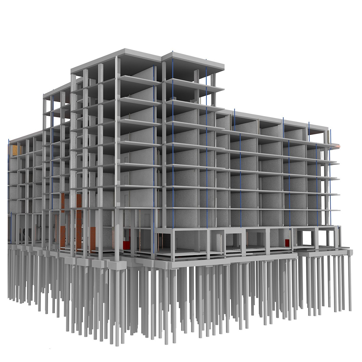
We collaborate with other design disciplines and suppliers to provide BIM to level 2 maturity on an ever-increasing number of our projects, using a variety of authoring tools for presentation, design development, production information, 3D coordination and asset management.
RIBA Stage 5 - Construction
Applications that enable client groups to observe and interact in a virtual environment and visualise key external and internal spaces using handheld devices also provide valuable support to our BIM process. Complemented by in-house-developed drawing management and space planning systems and facilitated by a strong backbone of IT infrastructure, the value provided to our clients is always maximised.
RIBA Stages 6 to 7 - Management
All of this is delivered as part of a constantly evolving strategy with input from both technology specialists and key business leaders. We offer our clients the tools to better design, understand and manage their developments.
our cgi, BIM & drone surveys services
We provide a bespoke service tailored to your needs to realise your development vision.
Static or Animated CGI
Drone Survey - Light Detection and Ranging (LiDAR)
Live Interactive Models - Web Browser & VR
BIM